
September 17 - [9.5 Miles/182.3 Total] Sherburne Pass to Governor
Clement Shelter. Between goodbyes, food sorting, and a really horrible Burt Reynolds
movie it was 9:45 when I left the hotel and 10:00 before I reached the trailhead. The
plan was to hike 15 miles a day for the rest of the hike to complete the trail in the
time I had left. On the way up Killington I ran into another hiker going down. He told
me that on the top of the mountain was a side trail leading to the summit and a restaurant. So I was
forced at that point to make a decision between a 15 mile day or a side trip to the
summit for a good lunch. Being a hiker I of course chose lunch which was expensive but
pretty good. I had beef stew in a bread bowl, a chicken sandwich, and onion rings.
After several hours on the summit I hit the trail again to finish my 9.5 miles day.
|
September 18 - [19.4 Miles/201.7 Total] Governor Clement Shelter to Lula Tye Shelter.
This was a sunny, cool, partly cloudy and uneventful day. Although I passed maney hikers
I ended up alone at the shelter that evening.
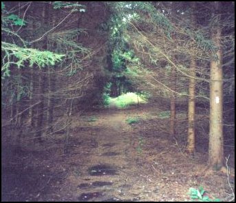 |
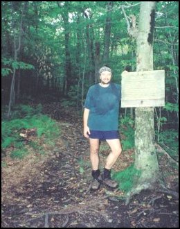
Flat Trail
I was so excited to find long flat trail after all the difficult trail I traveled in the
past few weeks that I took a photo. All I know about this picture is it is somewhere
between Governor Clement and Lulu Tye shelters.
|
|
September 19 - [16.5 Miles/218.2 Total] Lula Tye Shelter to Bromley Ski Patrol Hut.
This was yet another fairly uneventful day. That afternoon I was warned by several northbound
hikers that the water hand pump in Mad Tom Notch just below Bromley did not work. Since it was
to be my evening water source I was a little worried. Once I got there though it worked just
fine. I am guessing it was just a case of hikers not knowing how to use a hand pump. You have
to pump hard and fast to get it started before you get anything out. Maney hikers will walk up
to a pump like that and pump very slowly a couple of times and wonder why there is no
water. On the way up Bromley I spotted the trail to the old Mad Tom Shelter. I followed
what was left of the trail to see what remained of the shelter. The pinic table was still
in tact but the shelter had fallen of its pillars and the walls and roof were down. Too
bad really, that still is a great location for a shelter. In any case I continued the
mile on so to the summit of Bromley and the ski patrol hut. In the hut that evening
I finally felt certain that I would complete the whole trail.
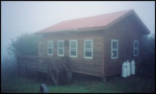
| Bromley Ski Patrol Hut
This is the Bromley skit patrol hut on the summit of Bromley mountain. The ski
area allows hikers to spend the night here. I can't thank the ski folk enough
for their kindness. I stayed warm and dry as it rained hard and heavy outside
that night.
|
 |
|
September 20 - [16.4 Miles/234.6 Total] Bromley Ski Patrol Hut to Stratton Ski Patrol Hut.
The day started out wet and foggy but the fog burned of to yeild to a warm, sunny day. I passed
several hikers along the way including a slack-packing north-bound AT hiker named Gambler who
really needed to pick up some quick miles to have a chance of finishing. I also met an English
guy who was working on a section of the AT. He and a friend started at Springer Mt, Ga in 1994
and had flown over every year to pick up another section. Now that's dedication! The Stratton
Ski Patrol hut was even better than Bromley. There was electricity, running water, flush toilets,
heat, a microwave, and a TV!! This was a better setup than maney hiker hostels I've stayed at!
This was also the first night was not alone since Sherburn Pass. With we that evening was a
section hiker named Alex.
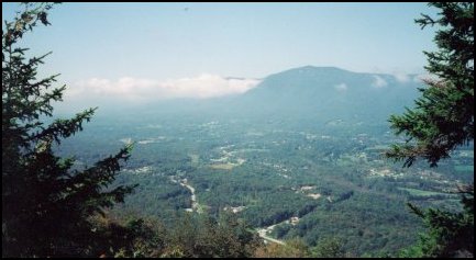 |
View From Spruce Peak
This was only an hour or so after I left the wet, foggy summit of Bromley. It often
amazed me how quickly the sky could clear.
|
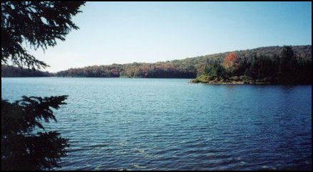
| Stratton Pond
I passed this beautiful pond in the late afternoon shortly before the climb to the summit
of Stratton mountain. This is the largest body of water on the Long Trail.
|
 |
|
September 21 - [16.3 Miles/250.9 Total] Stratton Ski Patrol Hut to Goddard Shelter.
As I watched the sunrise from the Ski Patrol hut a giant black cloud blew in from behind. Shortly
afterward there was wind, rain, thunder, & lightning. It rained on and off the rest of the day as
the temperature droped. That night was miserable, cold and windy. The wind blew right up through
the florboards and was strong enough to shake the shelter at time. I woke up shivering several
time the night in my 20 degree sleeping bag. I ended up taking my tent out and using it as a
blanket to keep warm. That was one night I was happy to see end! I did have company that night,
two AT section hikers named Frenchy and Bear.
|
September 22 - [14.4 Miles/165.3 Total] Goddard Shelter to Congdon Shelter
This turned into a beuatiful, leasurely, day. Here is an excerpt from my journal:
"Today's miles went quick. I had nine done by lunchtime so I had the rest of the day to play
with. [...] I stoped by a creek for about twenty minutes and just enjoyed being there. I had been
told by a man on the [VT 9] climb about Harmon Hill. This is a sumit meadow kept clear by regular
conrolled burns. When I got there I found a perfect patch of grass and the sun was out; I could
not resist. I layed down in that grass, basking in the sun for an hour and a half. [...] I
arrived [at the shelter] around 4:50 even after all those breaks. What a great day of hiking!
I was thinking today with the rush to get the miles done, to finish, I forgot to enjoy being out
here. Some of the best times occurs not while hiking but while sitting quietly with the world
before me and not a care in the world. [...] I will miss the trail but I am ready to go home."
|
September 23 - [10.0 Miles/175.3 Total] Congdon Shelter to the Massachusetts Border.
 |
The End of the Long Trail!!!
Well this is it, the end of the trail. This trail's end was a little
different than what I have experienced at the end of past trails. On this
note I'll defer to my journal.
The last miles went quickly as the anticipation drove me ever faster. [...]
As I approached the end I could make out signs and a video camera. I guy who
was just starting a thru happen to be carrying a video camera and tripod and
he recorded my appraoch. I arrived at the first sign and I touched it as I
read the front. The two other people there were two younger (20s?) attractive
women. One of them asked if I was completeing a thru. I told her yes and they
both started cheering. One high fived me and the other gave me a big hug. [...]
Its not too often you have cameras and [cheering] women waiting for you
at the end of the trail!
|
|
|
Send Comments To
khoffman AT computer.org
Last Updated on November 10, 2000
|